Application
MOTIONTAG RETHINK

Application
MOTIONTAG RETHINK


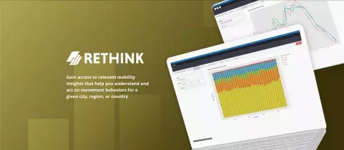
No need to deal with heavy datasets or additional geospatial processing, get all the relevant information you need either on a periodic report or via on-demand access to our solution. Understand the distribution of modes of transportation for a given day, week, or month either by number of tracks or distance. Get information on the times of either a weekday or a weekend day, the highest concentration of trips and what are the preferred modes of transport being used. Observe how these trends change within a city, region, or country given a specified point of origin or destination at affecting distance times, number of trips, or distribution of modes used at these locations.
Price Model
License of access based on frequency and desired geography.
- On demand mobility insights
- Self service
- Easy to use
Want a look at the code?
This application is an open source application. Therefore, you have the possibility to view the programming code of the application and use it yourself if you are interested.
This button will take you directly to the specific location where the application is stored.
This button will take you directly to the specific location where the application is stored.


Jose Quispe
Product Manager