Skip to Content
Die Lösung
Die Lösung

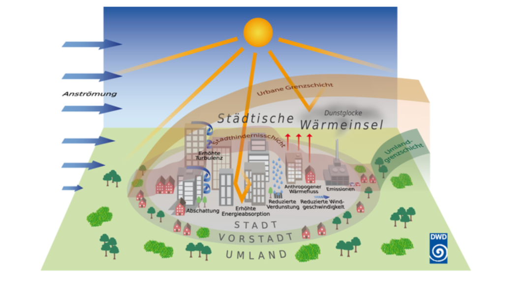
Monitoring of heat islands to take action

Umwelt
Environment
Gesundheit
Health
Stadtplanung
Urban Planning

Monitoring heat islands

In order to identify the places in the city where particularly high levels of heat accumulate resulting in heat islands, data on the temperature at as many locations as possible is needed with maximum accuracy. By monitoring these temperatures, heat islands in the city can be identified and measures to cool them down can be examined. Likewise, particularly cool locations can be designated as refreshment spots. In addition to conventional weather stations, floating car data is a particularly suitable data source for such monitoring: Cars move throughout the city and can provide accurate information on the temperature at different locations without the need to install additional measuring stations.

Sustainability check: How does monitoring heat islands help?

  • Identification of particularly hot and cool locations within the municipality.
  • In conjunction with other data, correlations can be made between temperature and factors such as traffic volume, tree cover, ground conditions, building height, etc.
  • Provide a data-based foundation for short-term measures such as greening (e.g., facade, roof, and building greening, increasing tree cover and downtown vegetation)
  • Information can be incorporated into urban planning in the long term, e.g. for planning fresh air corridors

Requirements: What is needed for monitoring heat islands?

  • Data from local weather stations
  • Floating car data from the desired time period, or multiple time periods
  • Other data to be included in the analysis, e.g., tree cadastre, traffic volume data, or building height data
  • At least a one-time analysis of the data to identify heat islands and cool locations

Our Rating:

Increasing temperatures are putting a strain on people and the environment and already pose a problem for many cities in summer. A further rise in temperature is to be expected in the coming years. In order to identify heat islands, it is not strictly necessary to measure and evaluate urban temperatures on a constant basis. Rather, simple reporting, ideally covering several points in time during the year and conducted at regular intervals of a few years, can provide important information. Based on this information, particularly hot locations can be identified and various short- and long-term measures to reduce urban temperatures can be tested.

Which SDGS are addressed?

In order to create globally sustainable structures, the member states of the United Nations have set themselves 17 goals by 2030, which are set out in the 2030 Agenda for Sustainable Development.

image description
image description
image description
image description

Associated challenge(s)

(The) Challenge(s) that can be overcome with the help of this solution.
image description

Regulating temperature in the city

  • 1 Solution(s)
  • 3 Datasource(s)
Previous
Next

Matching data(sources)

Obtain data(sources) for this solution here:

image description

Open Weather Map API

image description

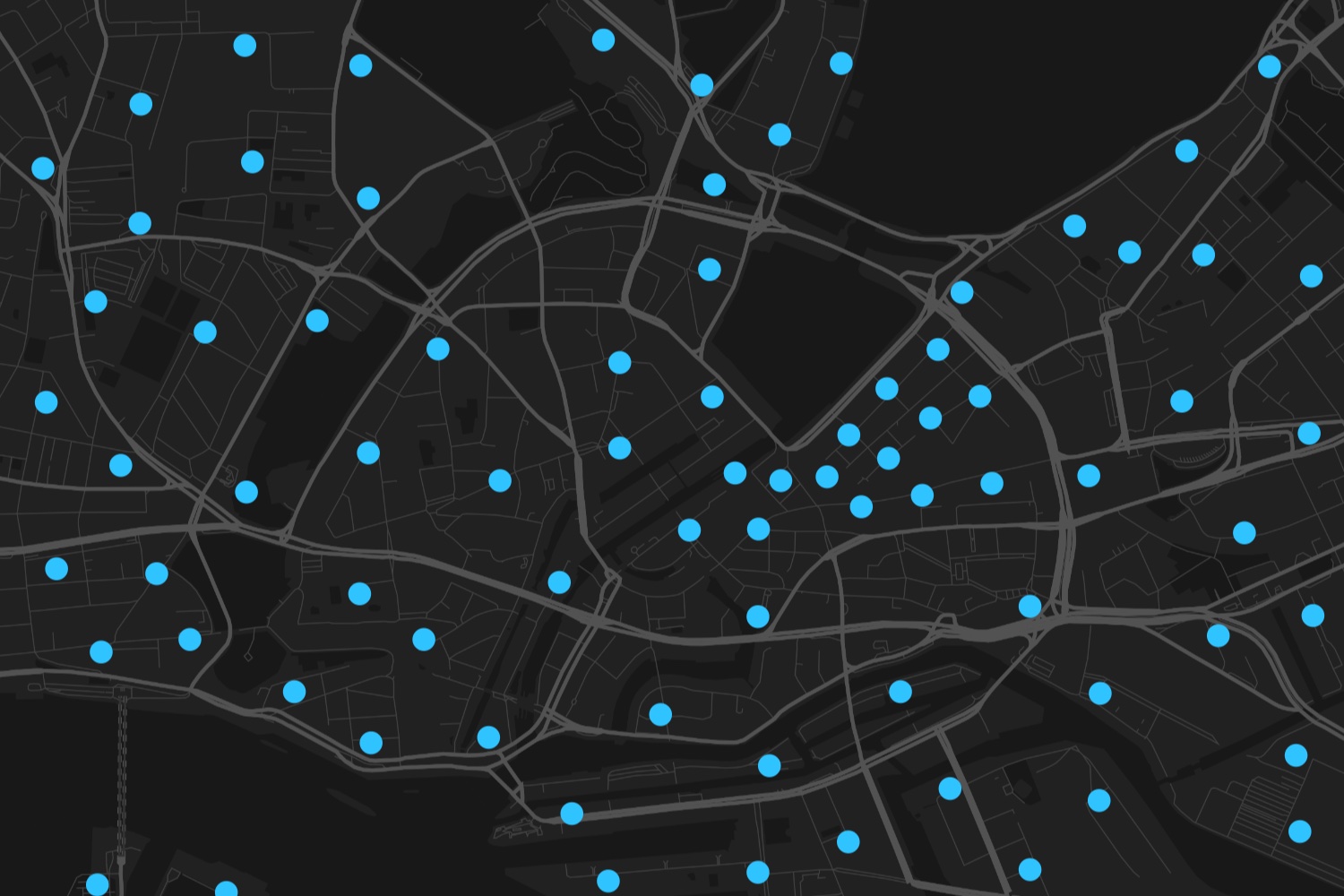
Air quality data from Breeze Technologies

image description

Air quality data Hawa Dawa

Previous
Next
Back to top