Skip to Content
THE CHALLENGE
Newicon 1 0
THE CHALLENGE

Protection against floods

Umwelt
Environment
Sicherheit 
Security
Wasser
Water

Protection against floods

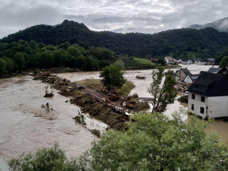
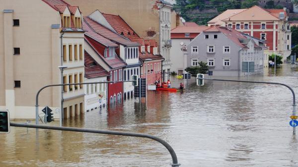
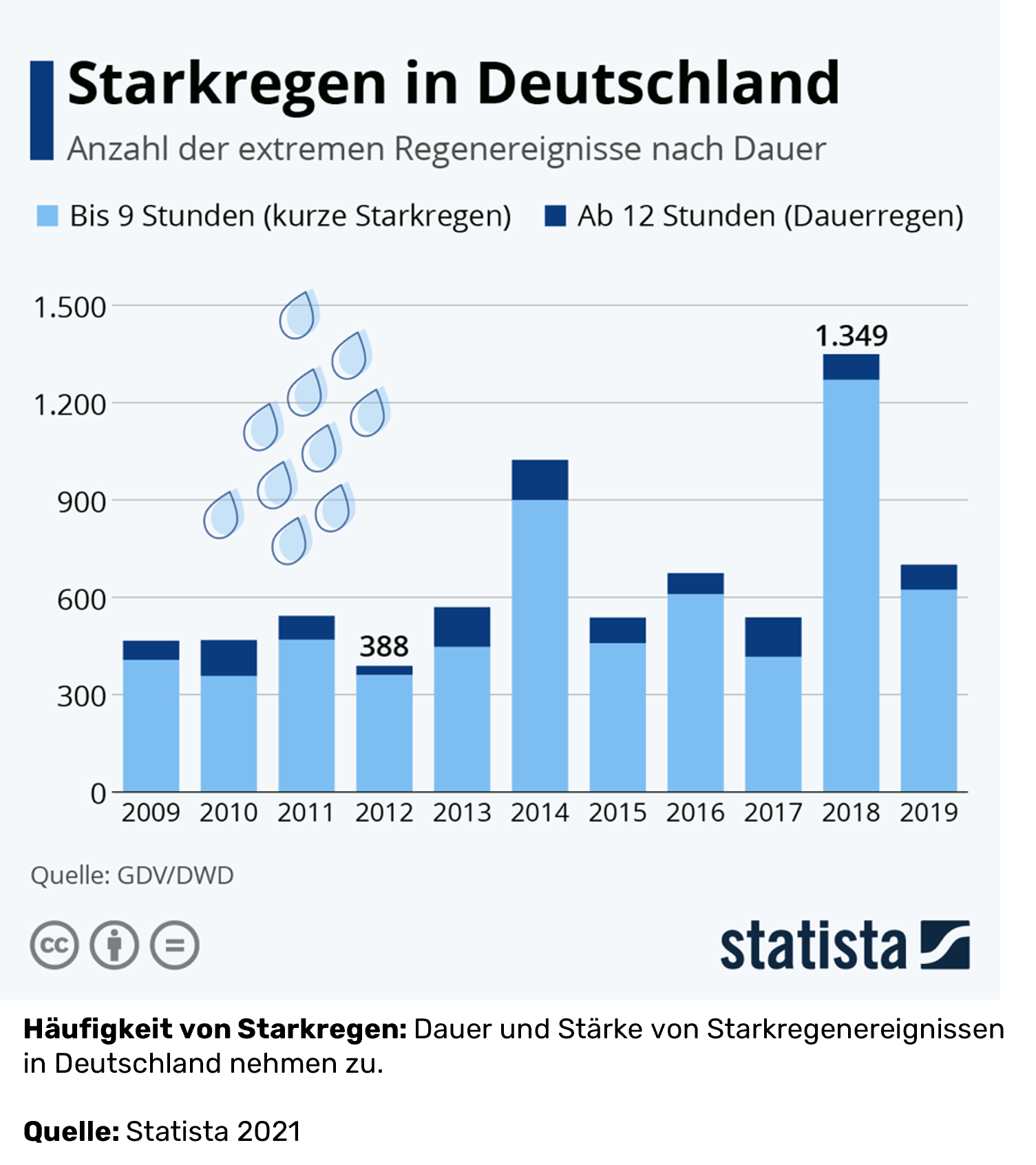
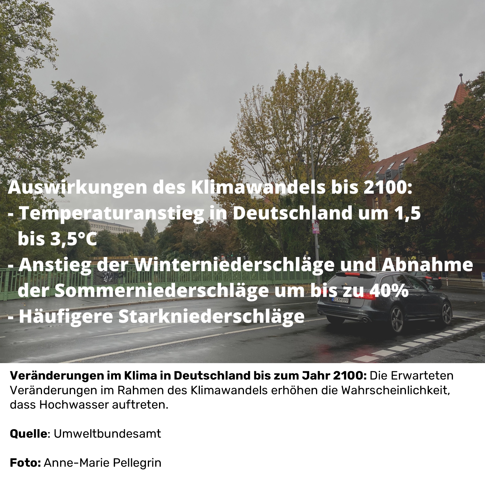
Floods triggered by heavy rain in July 2021 cost the lives of 134 people in Germany - many more lost their belongings, and entire villages and neighborhoods were destroyed. Such extreme weather events are occurring with increasing frequency as part of climate change. The disaster risk is also intensified by straightened stream and river courses, by forest and tree dieback, or by the close development of riparian regions.   

While the renaturalization of watercourses, the creation of floodplains or reforestation require a longer implementation period, cities and regions can protect their populations more quickly and better through data-based solutions.

image description

Many municipalities already have the necessary data and could take action in a timely manner. The better this information is networked, combined and processed for the general population, the more targeted countermeasures can be initiated. As a result, infrastructures and human lives can be protected.


APPROACHES

  • (Supra-)regional cooperation: The more municipalities rely on data-based solutions and exchange information supraregionally, the better the forecasts and the greater the options for action.
  • Bundle data: Different geodata systems can be confusing.
  • Prepare data for (new) target groups: Existing early warning systems tend to target experts, not the general population.
  • Strategies for early warning of the population must be established and known: whether by means of NINA, the federal government's warning app, or by means of a website, radio and/or telephone, so that the population can also be reached in the event of a power blackout.

Opportunities

  • Protection of infrastructure, property and human life.
  • Low investment and maintenance costs, since only a few sensors are usually sufficient.
  • Data in flood protection is not only important in the direct event of a disaster; precautionary measures can also be used to identify and analyze endangered areas and thus initiate suitable flood protection projects.
  • By simulating disaster situations using digital twins, it is possible to rehearse how to deal with disaster situations and develop suitable protocols for emergencies.

Solution(s)

Flood hazard map

Early warning systems for flood events

image description

Open Weather Map API

Data

Data and Facts about this topic

Previous
Next

Which SDGS are addressed?

In order to create globally sustainable structures, the member states of the United Nations have set themselves 17 goals by 2030, which are set out in the 2030 Agenda for Sustainable Development.

image description
image description
image description
image description

In the Open Urban Data Community, municipal actors can network with each other, engage in conversation, and work together on implementations. Benefit from the cost-free formats for the community!

You would like to be a part of the community?

image description

Adoptable realizations

Already successfully realized by community members or currently being implemented:
image description

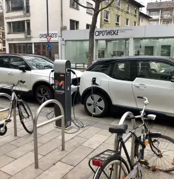
Mainz - Improve e-parking

image description

Shared Mobility Dashboard for Cologne

image description

Freiburg - Live traffic visualization

image description

ASCEND research project clean energy districts

Previous
Next
Back to top